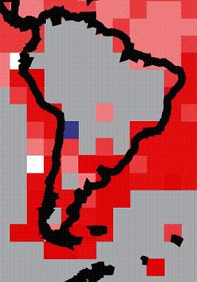
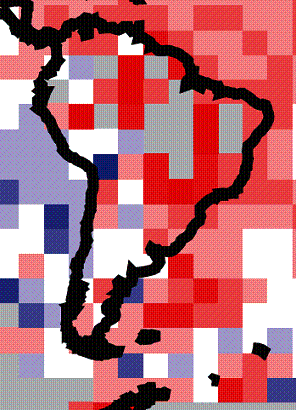
South America Study In 5x5 Degree Grids
This is part of the Regional Summary series at www.appinsys.com/GlobalWarming
The IPCC calculates average temperatures based on the average temperatures in 5x5 degree grid “squares”.
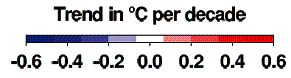
The IPCC AR4 (Figure 9.6, 2007) shows the following:
Left: 1901 – 2005 Right: 1979 – 2005
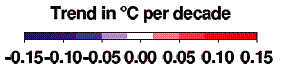
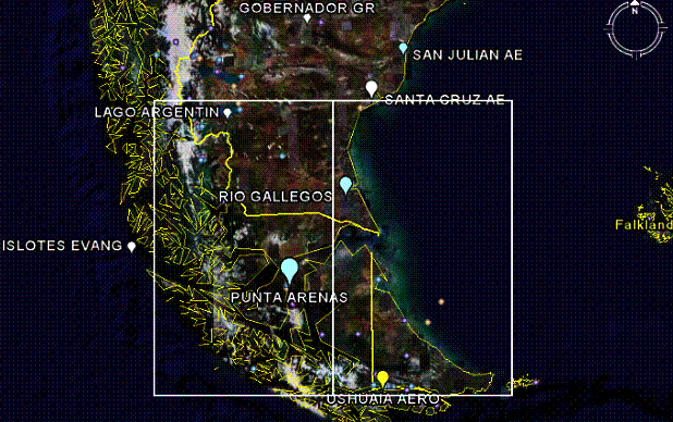
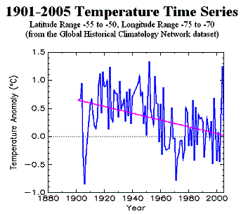
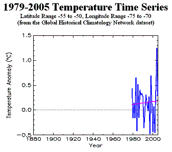
Southern tip of South America: [Lat 50-55 (s) x Long 70-75 (w)] and [Lat 50-55 (s) x Long 65-70 (w)]
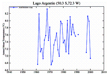
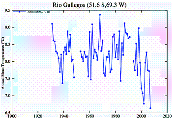
The IPCC shows warming in both of these grids for both time periods. The figures below show the grids superimposed on Google Earth showing temperature stations [http://dev.edgcm.columbia.edu/wiki/StationData] along with GISS individual temperature station plots [http://data.giss.nasa.gov/gistemp/station_data/] for the grids. Note: there are only two temperature stations available within each grid. No global warming is evident in any of the detailed data, but IPCC shows warming.

![]()


![]()
![]()

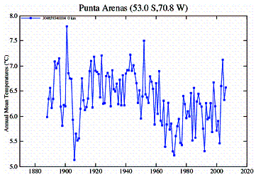
The following graphs show the [Lat 50-55 (s) x Long 70-75 (w)] averaged raw GHCN temperature data for the two periods (from [http://www.co2science.org/scripts/CO2ScienceB2C/data/temperatures/ghcn.jsp]
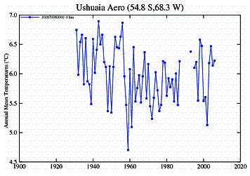
The following graphs show the [Lat 50-55 (s) x Long 65-70 (w)] averaged raw GHCN temperature data for the two periods
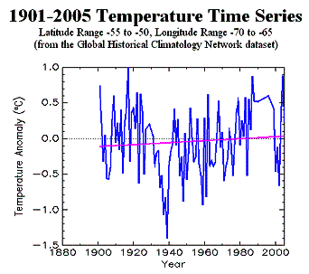
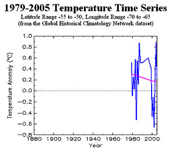
The warming trend identified by the IPCC is not obvious – i.e. their decadal rates are not supported by the data.
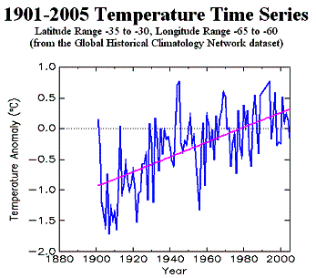
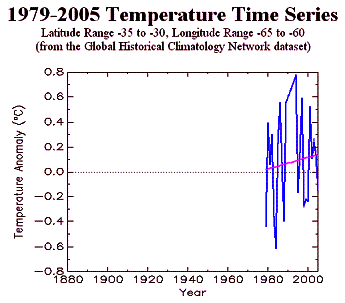
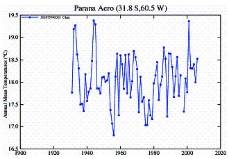
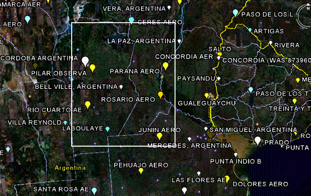
Southeastern South America: [Lat 30-35 (s) x Long 60-55 (w)]
The IPCC shows substantial warming in this grid for both time periods. The figures below show the grid on Google Earth showing temperature stations along with individual temperature stations. This 5x5 grid has eight temperature stations. The longest-term stations are shown with the map, the rest following it.
![]()

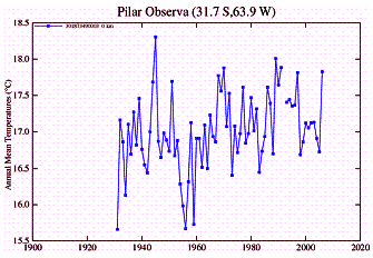


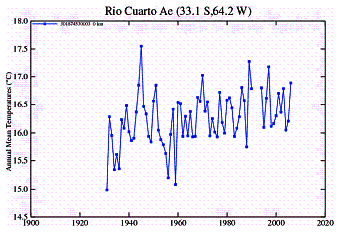

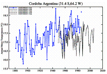
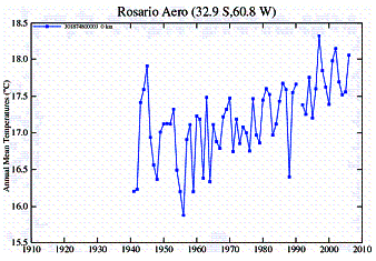
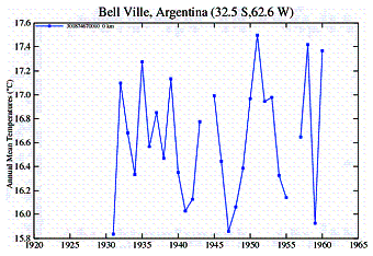
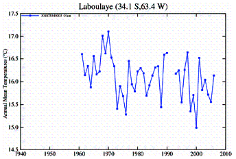
The following graphs show the [Lat 30-35 (s) x Long 60-65 (w)] averaged raw GHCN temperature data for the two periods. The effect of the rapidly growing urban areas (Cordoba, Rosario, Rio Cuarto) is exhibited in these plots, as well as the effect of averaging, since most stations do not exhibit significant warming.