Tucumcari – Comparison of GISS and GHCN
Data
Tucumcari 4ne (Station 425747310030) provides an example of unexplained differences in temperature data between the NASA GISS data and NOAA GHCN data.
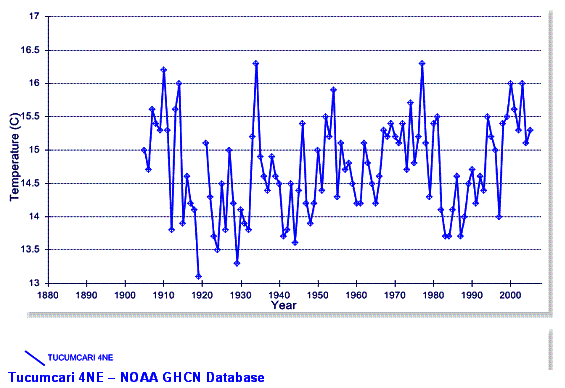
The following figure shows the Tucumcari annual mean temperature
data from the NOAA GHCN database (plot created at: http://www.appinsys.com/GlobalWarming/climgraph.aspx?pltparms=GHCNT100AJanDecI188020080900110AR42574731003x)
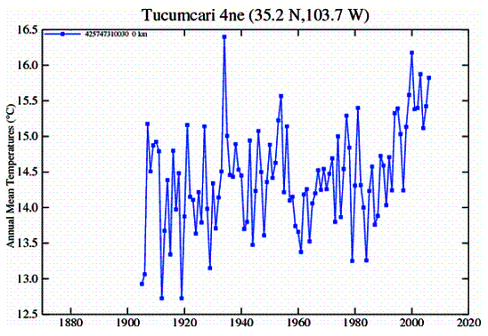
The following figure shows the Tucumcari annual mean temperature data from the NASA GISS database (plot created at:
The following figure compares the annual mean temperature data from the previous two graphs (GISS data in red, GHCN data in blue).
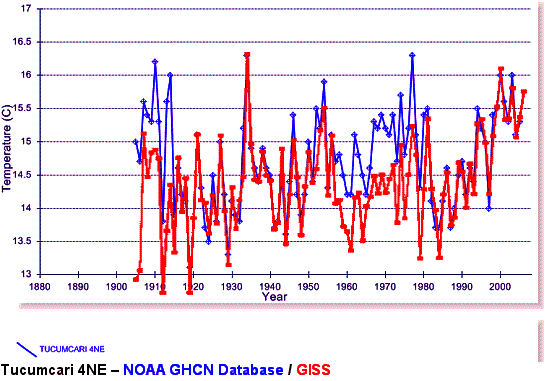
Most of the years have similar values – although, there are a couple of periods with distinctly different values. The GISS data is called “raw GHCN plus USHCN corrections”. Thus these “corrections” to the raw daat are evidently producing the observed differences.
The following two figures show the GHCN and the GISS data for the period 1957 – 1980 which is seen above to be a period of discrepancy.
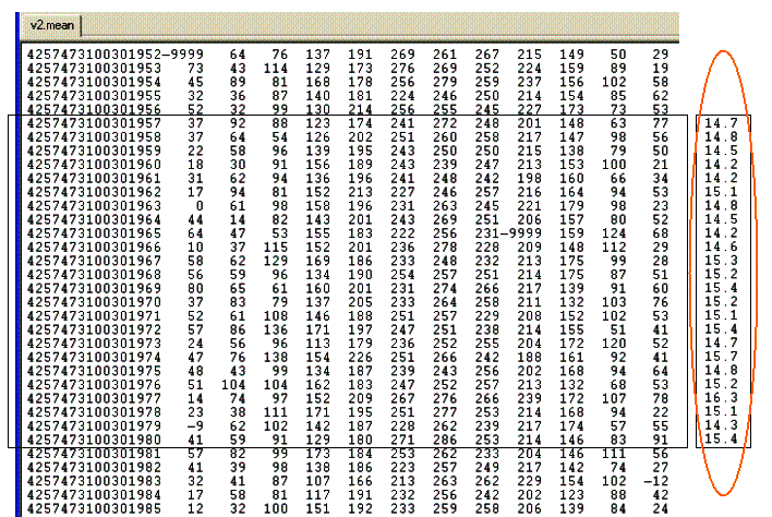
NOAA - GHCN Data (ftp://ftp.ncdc.noaa.gov/pub/data/ghcn/v2):
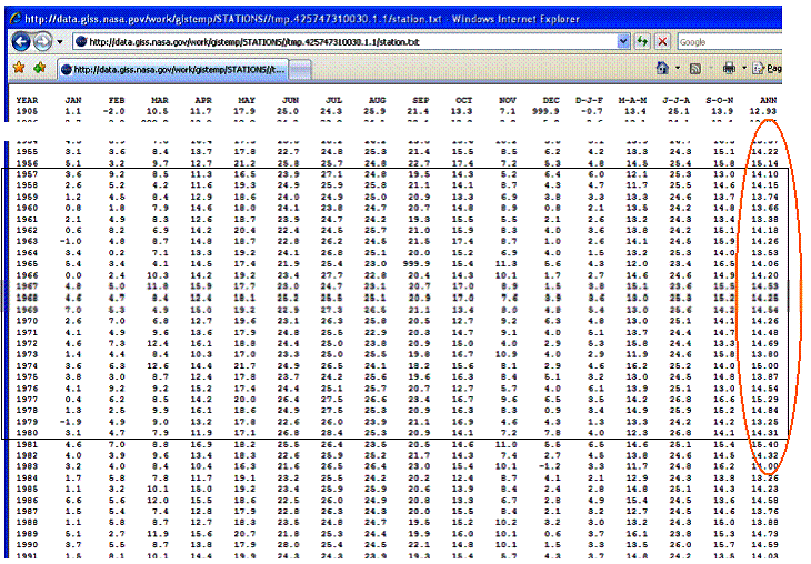
NASA - GISS Data (http://data.giss.nasa.gov/work/gistemp/STATIONS//tmp.425747310030.1.1/station.txt):
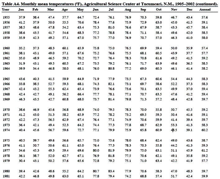
So which data is correct? Another source of information is the New Mexico State University, Agricultural Experiment Station, Research Report 751 [http://tucumcarisc.nmsu.edu/documents/rr751.pdf]. Table A-4 provides mean temperature data (excerpt shown below – degrees F).
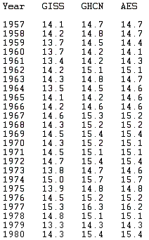
The following table compares the NASA GISS with the HOAA GHCN and Agricultural Experiment Station (AES) for 1957 - 1980. The AES data closely matches the NOAA GHCN data for the period in question, not the NASA GISS data. So the discrepancy may be the “USHCN corrections” made by NASA. What these “corrections” consist of is apparently undocumented on the NASA GISS web site.
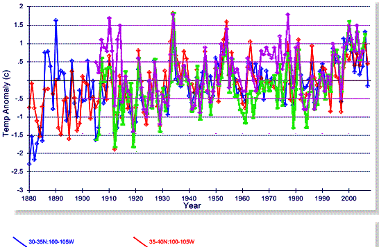
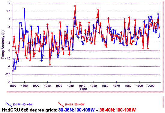
The following figure shows the Hadley Climatic Research Unit (HadCRU) data for the two adjacent 5x5 degree grids (since Tucumcari is at 35.2 N). The HadCRU gridded data is averaged for the stations in the grid after adjustments are made to individual stations. HadCRU does not publish individual station data – only the adjusted gridded data are available.
The following figure superimposes the GISS data (green) and the NOAA data (magenta) for Tucumcari on the HadCRU gridded data.